Sunday, August 8, 2010

Relay Peak


August 8, 2010   

Relay Peak is the one on the far left side, not the one with antennas


Ron and John, training with full packs

Mt Rose from Relay Peak

A smokey Lake Tahoe basin, from Relay Peak

Ron and I, on Relay Peak

Mt Rose, from near the trail junction

Saturday, July 31, 2010

Donner Pass to Anderson Peak and Benson Hut

July 31, 2010

Parked at Donner Pass, hwy 40. Almost all the snow is gone from the trail now, just a bit on the shady side next to Mt Disney.


Deer near the ski lift

Anderson Peak on the hirizon

Anderson Peak


Looking west to the American River canyon

Looking north to Mt Disney and Castle Peak

Benson Hut on the north slope of Anderson Peak

Anderson Peak

Saturday, July 17, 2010

Mt Rose

July 17, 2010


Why are raspberries on a pine tree???

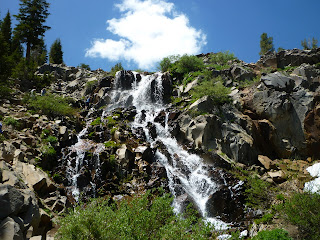
The Falls
The Falls

Our group, on the way up

Lake Tahoe from Mt Rose summit

Reno from Mt Rose summit

On the way down

Friday, July 9, 2010

White Mountain Peak - July 9, 2010

This is the descrition of the White Mountain Peak hike, on July 9, 2010.


Thanks for the warning!
High camp, at 12,000 ft
My Toyota ad, at "locked gate" camp area.
Bayard, me, and John, with White Mtn Peak in background

The Univ of Calinfornia research station

The summit hut

It's a jeep trail, some flat, some steep, to the summit

Walking towards the White Mtn summit.

Me in from of White Mtn Peak

The last couple of miles to the top
Me at the summit, adding 6' 4" to the overall height of the mountain
Amazing snow features

Bristlecone Pine

Bristlecone Pine

Bristlecone Pine

Bristlecone Pine

Bristlecone Pine

Friday, June 11, 2010

Jones Whites Creek Creek loop

The Jones Whites Creek loop, just southwest of Reno, is at a relatively low elevation, so it is an early-season hike, since snow clears there pretty early. It's a loop trail, about 9 or 10 miles long. Most of the trail was clear, but there were a couple of snow patches on the north facing slopes.
One of the best features is that you hit varying types of terain; from dry exposed desert, to pine forest, to rushing creeks.

Friday, May 7, 2010

Fuller Lake

Due to the late snowpack, early season hikes this year have to be at lower elevations, so we took an easy hike to Fuller Lake. It is located near the CA NV border, just east, and across the Truckee River from Gold Ranch casino. Parking is at the end of Belli Ranch Road. Cross the railroad tracks, and head uphill to the south east. The trail is actual a series of dirt and gravel jeep trails. Not much of a hike, but a good pre-season hike to get the legs working again.
The lake is an old Boy Scout camp, and it has old buildings that are in serious need of attention.


Looking north, towards Gold Ranch, across the Truckee River

Fuller Lake

John and Ron

Looking West across I-80

Thruckee River, and I-80

Fuller Lake, with Boy Scout knot-tying everywhere!